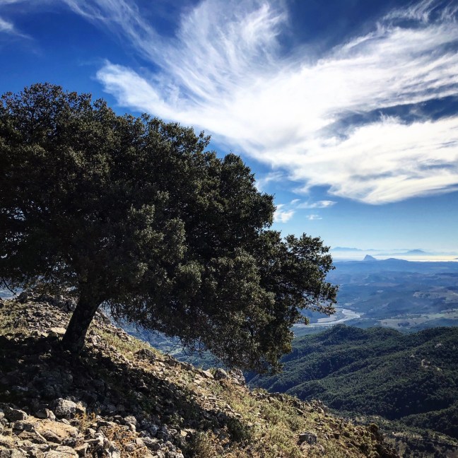
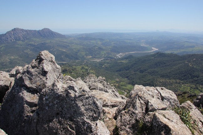
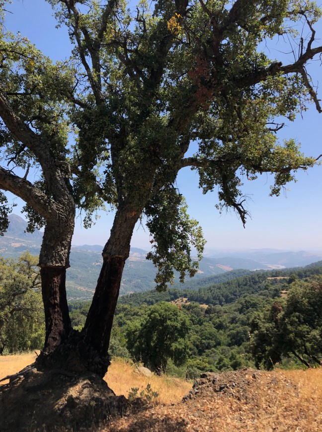
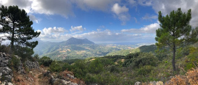
We moved to Gaucin for the walking; we think Gaucin and the surrounding hills and mountains offer some of the best walking in the world. People living in the Swiss Alps, the Drakensbergs, and Yellowstone Park might quibble, but the landscapes, the flora, the colours and the light around here are very hard to beat. And with 320 days of sunshine a year, there is plenty of opportunity to enjoy them. Just don’t forget the sun cream if you’re here in the summer.
- Venta Socorro to La Claridad
- La Umbria
- Down the valley and back via Camino Molino
- Up and down the Hacho
- Around the Hacho
- Las Palas Gigantas and Claridad
- The Ermita
- La Corchuela, Jarraqueque and Avedin
Walking country
Our landscape is epic, and it can be slightly forbidding to wander off into the countryside when you’ve just arrived in a new place, especially if you’re not fluent in the language. It took us a while to get familiar with the territory when we arrived. So we’ve created a shortcut, just for you. Using a very helpful app called Wikiloc, we have mapped eight of the best walks from the door of the house and back. We have included photos of major decision points on Wikiloc to reassure you that you are on the right track.
Wikiloc
You can find Wikiloc, unsurprisingly, at www.wikiloc.com. It describes itself as “a place to discover and share the best outdoor trails for hiking, cycling and many other activities.” An apt app, it was created by Spaniards. You can record a walk while doing it, or (if you have paid a minimal annual fee) you can download somebody else’s walk and follow it. Because Wikiloc uses GPS rather than a cellphone connection, it is virtually impossible to get lost. So you can forget about trying to figure out where that track you were following disappeared to, and whether or not to go through that gate ahead of you, and instead just pay attention to the marvellous scenery around you.
Although you don’t need an internet connection to follow the trail, you do need one to download it. It is imperative that you download the trail before you leave the house. (There is actually pretty good signal all around here, but the wi-fi in the house is better.) Warning – regular use of Wikiloc can make you sloppy: Calum learned this the hard way walking in the desert near Petra in Jordan, fortunately he survived despite climbing the wrong mountain.
Patrick Elvin
Aside from Wikiloc, the other thing we recommend to enhance your walking pleasure is the guide books by our friend Patrick Elvin. Patrick is a fabled institution in these parts: he has been tramping around the nearby hills almost since they were formed, and he has published a series of invaluable companion guides. This article is based on the first one in the series (available from Amazon at https://amzn.to/2Vkg6oI). There is a well-thumbed copy of this in the house.. Patrick also initiated a fine tradition of group walks which are organised most Tuesdays and Fridays. They are friendly and well-attended, and a great way to meet some locals and other visitors. If you are interested in joining one, let us know.
The walks
The walks are presented more or less in order of increasing length and effort. They are all circular walks starting from and ending at the door of Vista de Carmen – our house. We give very cursory descriptions, partly because we find that descriptions of walks have little resonance until you have done them, but mostly because you can find good descriptions in Patrick’s book.
The URLs link to the Wikiloc page, and Patrick’s numbers generally follow a municipality system. If the URL doesn’t work, you can find the walk by searching for Calum’s Wikiloc user name, which is cccalum. The vital statistics are in imperial because you can’t teach an old dog (i.e. Calum) new tricks, and the times given don’t make allowances for rest stops.
Usual rules apply
Wear sturdy footwear. We once had to leave some would-be walkers at a bar near the start of a trail and return to collect them later because they turned up in ballet pumps! Take lots of water, then pack some more, and in the summer, wear sunscreen and a hat. Leave gates open or closed as you found them, and say hello (“Hola!”) to any locals you encounter on the trail. Some of the paths are encroached on by prickly shrubs, so wearing shorts can be perilous. Light-weight and light-coloured trousers (not jeans) are advisable, and Calum loves a wicking shirt.

In October – June we aim to be safely home before dark; in July, August, September we go out just after sunrise and make sure we are home by 11am (limiting walks to around 4 hours max). In the high summer the temperature rises throughout the day, so the evening is typically not an option even if the sun is less fierce.
OK, here we go…
- Venta Socorro to La Claridad
Wikiloc URL: bit.ly/2WE2UwC
Patrick’s number: 13
Vital statistics: 2.7 miles, 50 minutes, up and down 413 feet.
A gentle start. A short circular walk heading downhill from a rather fine bridge whose charm is undermined by the fact that its construction was funded by the Nazis. You descend into a forest of pine and cork oak, and there are views towards a nearby village, Cortes de la Frontera. Towards the end you are rewarded with fine views of Gaucin.
- La Umbria
Wikiloc URL: bit.ly/2HeZsDn
Patrick’s number: 6
Vital statistics: 5 miles, 1 hour 40 minutes, up and down 574 feet.


An easy walk with no steep climbs or descents. Some shade along the way, and terrific views of Cortes, Gibraltar, and Gaucin.
- Down the valley and back via Camino Molino
Wikiloc URL: bit.ly/2VvuAah
Patrick’s number: 14
Vital statistics: 3.2 miles, 1 hour, up and down 787 feet.
This is our daily exercise routine – we call it ‘the stairmaster’ – when we don’t have the luxury of time for a longer walk. It’s a fairly straightforward down and up, but it includes stunning views on both legs. The return path up the hill is very picturesque, and we defy you to refrain from stopping to gawp at one point. You’ll know what we mean when you get there.
- Up and down the Hacho
Wikiloc URL: bit.ly/2Heklyg
Patrick’s number: 1
Vital statistics: 3.2 miles, 1 hour 10 minutes, up and down 1,250 feet.
This is a pipe cleaner. As in, it will clean your pipes. No visit to Gaucin is complete unless you capture the view from the top of the mountain. A fairly steep climb up to the col of the Hacho (which means axe, after a protrusion which from some directions looks like a decoration on a Mayan temple), then a short flat walk to a turn-off, followed by another fairly steep ascent which takes you via a surprising viewpoint. The 360-degrees views from the top are stunning. You will feel thrilled and virtuous when you do this one.

There is a glorious profusion of Schiaparelli pink peonies in early May – not to be missed if you visit at this time of year.
- Around the Hacho
Wikiloc URL: bit.ly/2PXHSGF
Patrick’s number: 2
Vital statistics: 5.3 miles, 1 hour 45 minutes, up and down 1,100 feet.


People argue about which way round to do this walk, but there is a right answer. Start with the flat walk along the road and return by descending from the Hacho’s col. This affords a wonderful view of distant mountains when you make your first descent, and better views on the return leg, as you go through “Lone Ranger’s Gully” and “Speilberg-land”. To do it the other way round is frankly barbarous.
- Garganta Las Palas and Claridad
Wikiloc URL: bit.ly/2JdGTl5
Patrick’s number: 5
Vital statistics: 6.3 miles, 2 hours, up and down 1,010 feet.

A lovely walk throughout the year, but especially wonderful in the summer and autumn, when a small ravine (the “garganta” in the name) simply explodes with flaming pink oleanders. Childish, we know, but Calum actually bought a pink wicking shirt to wear on this walk.
- The Ermita
Wikiloc URL: bit.ly/2HjJk24
Patrick’s number: 3
Vital statistics: 5.7 miles, 2 hours, up and down 1,463 feet.
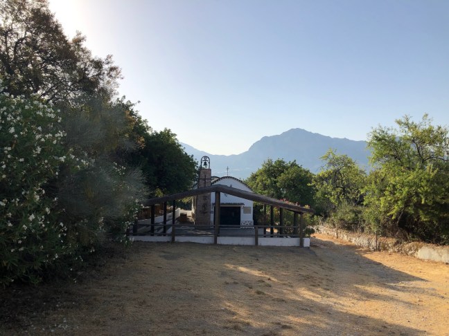
The biggest descent and climb back in this selection of walks, which means a fairly strenuous return leg, but definitely worth it. At the bottom is the atmospheric chapel (Ermita) of San Juan de Dios, a Portuguese soldier-turned health worker who is one of Gaucin’s two patron saints. This features in one of the village’s more curious ceremonies, the Romeria in late August – usually the hottest time of year – when heavy religious artefacts are carried down to the chapel and then walked back up the hill, with members of the congregation irrigated by grog carried on donkeys.
- La Corchuela, Jarraqueque and Avedin
Wikiloc URL: bit.ly/2E4apWa
Patrick’s number: 9
Vital statistics: 7.3 miles, 2 hours 30 minutes, up and down 1,330 feet.

The longest of these walks in distance and time, with a decent amount of ascent and descent, but not the most strenuous. A charming walk with fine views of several villages, Gaucin’s castle, and forested valleys. Take a packed lunch and don’t rush it.


glad to have found this page. I am a hiker and will be visiting Gaucin in May. Is the “walking group” still active? Would love to meet some locals.
thank you
LikeLike
Hi Olga – yes, you should ask to join their private Facebook group ‘Gaucín Hikers / Senderistas de Gaucín. All the walks are posted there. They go out on Tues and Fri. Have fun!
LikeLike